Day 26: Apple House Tentsite to mile 417.8, 24.6 miles
Day 27: mile 417.8 to Vandeventer Shelter, 18.3 miles
Day 28: Vandeventer Shelter to Abingdon Gap Shelter, 22.7 miles
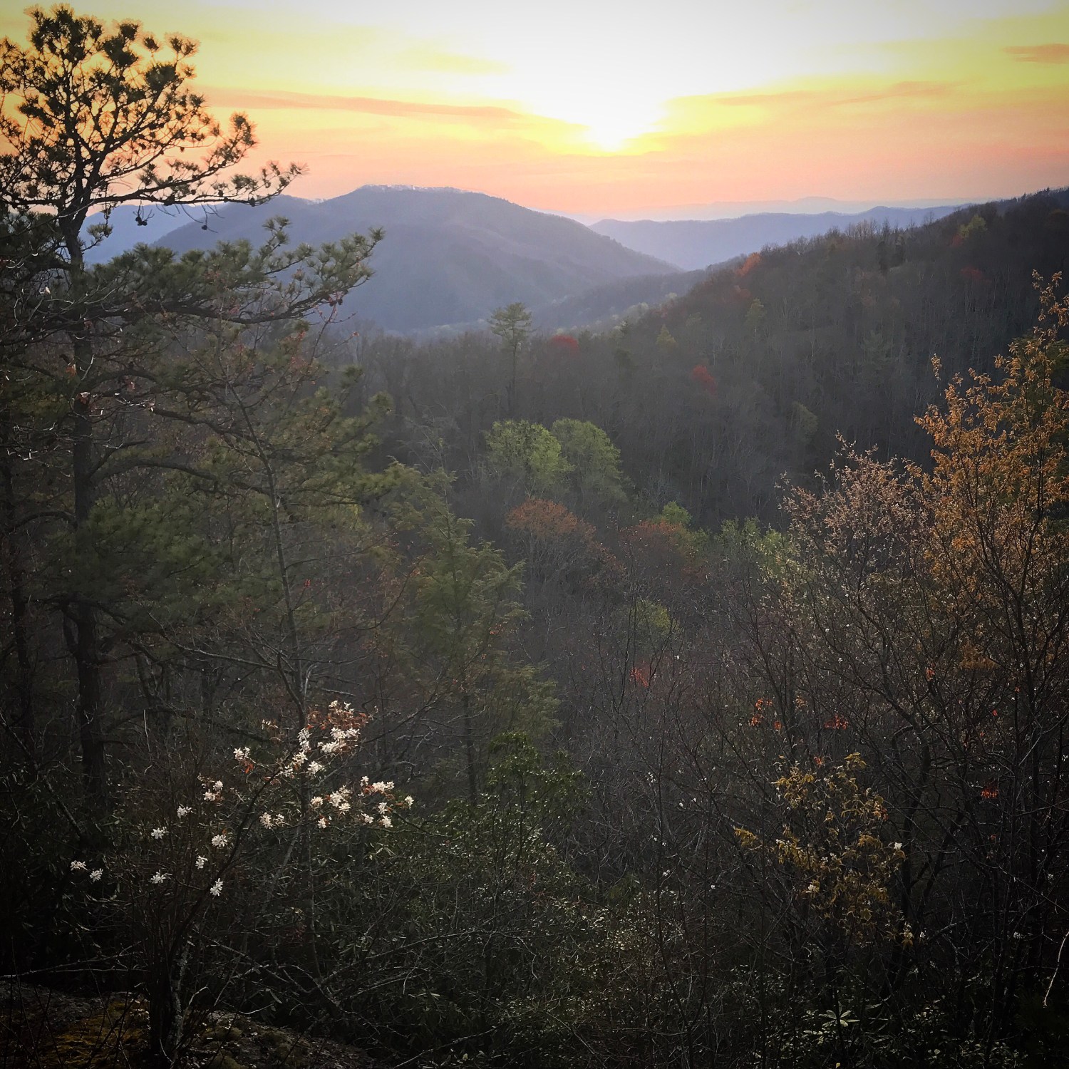
As the sun has been rising earlier, we have been too. We woke-up in our campsite by a little stream, and had breakfast. We were on the trail a little before 8am, and hiked gently rolling hills for most of the morning. We passed through a field with butterflies and wildflowers along the picturesque Elk River. 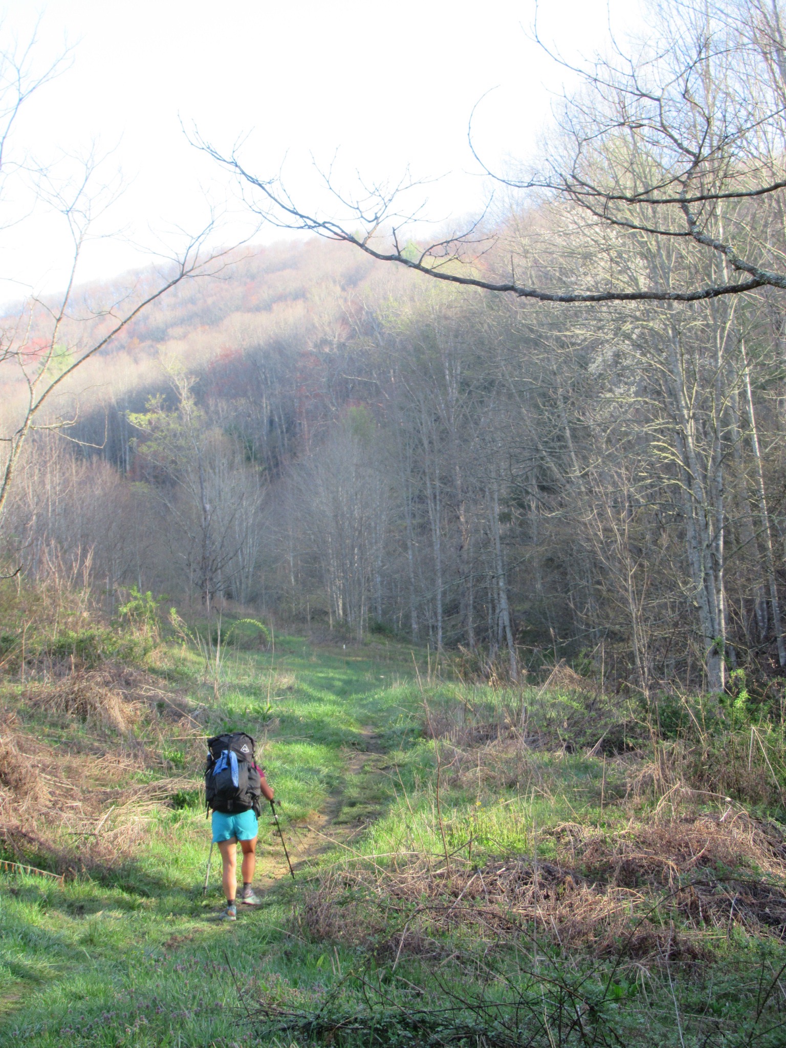 I was so enamored by the scene, that I walked right over the 400 mile marker. We stopped for lunch at a shelter a little under 9 miles into our day, and then continued on rolling hills. By the time we arrived at the next shelter another 9 miles later, we felt like we could walk some more so we made dinner and ate, then hit the trail for a couple more miles before making camp. There wasn’t water at the shelter, so we had to hike at least two miles to a “piped spring” listed in our guide. We’ve been hiking with a paper guide, AWOL’s guide to the AT, a thru-hiker staple for many years. It’s a great resource, as it has many waypoints and detailed town maps. Being paper though, it can’t tell us exactly on the trail we are like a GPS-enabled computer guide. This is all to say we were hiking to this “piped spring,” and there were no waypoints in the guide between the shelter and the spring to gauge how far we’d walked. We spotted a spring trickling down the side of the hill, but it wasn’t piped, and looking at the watch it seemed like we hadn’t talked long enough to have gone 2 miles. Since it would be harder to collect from that water than a piped spring, we decided to keep going a bit further thinking the piped spring would appear down the trail. Unfortunately, we guessed wrong, and that ended up being the spring we wanted, but we didn’t realize it until we hit the forest service road listed a half mile after the spring. We still felt good, and had enough daylight, so we pushed on to the next water 3 miles away. We were very happy to see it when we got there, and camped right before dark. Our unexpected miles pushed us to hike our longest day yet on the AT. We also got this incredible view of sunset!
Despite our long day the day before, we felt well rested the next morning. It had been awhile since we’d set-up the tent and away from other people, so it felt like a particularly peaceful breakfast. A few miles into the day we passed by Laurel Fork Falls, which were more impressive than I imagined.  We walked along the Laurel Fork for a bit, then had a two mile climb up a mountain, before dropping down to Watauga Lake. A woman in an RV was making egg sandwiches and had some drinks, which were grateful for! We ate quickly, and then attempted to hitch into Hampton, TN to resupply. We originally thought we’d need to buy two days worth of food, but turns out we’d bought nearly enough food in Spruce Pine a few days before to just need to eat lunch in town and buy a dinner. We didn’t even get our thumbs out before a worker for a local hostel drove by and offered us a ride in the back of his pick-up truck, we just had to lie low. Us and two other hikers climbed in the back of the truck, and piled in; our heads resting on our packs looking up at the sky. I watched the clouds for the quick 2.3 miles into Hampton, where we unloaded in the McDonald’s parking lot. We had lunch, picked-up Subway for dinner, then made one last stop at the gas station for a Gatorade. On our way out a man asked us if we were hiking, and offered us a ride back to the trail. A few minutes later we were back to the AT, successful in completing one of our fastest town stops to date!

By the way, these are my new shoes!
The rest of the afternoon didn’t go as quickly, it was all uphill, hot and humid, and the McDonalds was sitting heavy in my stomach- I probably didn’t need the shamrock shake, but I’d never tried one before (as uncomfortable as I was, it was so worth it). We walked through a four mile trail closure due to bear activity (the trail is closed to all camping, but hikers are allowed on the AT only as long as they don’t eat or “loiter”). We had to loiter, the humidity was too much on a full stomach, and after a few breaks to allow for digestion I started to feel a bit better as we started to another hill (and out of the bear closure- we didn’t see any signs of bear either). By the time we made it to the top 10 miles later I was hungry again, and we enjoyed our sandwiches with a nice view of the lake at Vandeventer Shelter.
The day after was another typical AT day, and we rolled through the mountains. Not typical however is that it was our first wedding anniversary, making the day feel quite special. The trail must have known, because when we made it to Abingdon Gap Shelter we were the only ones staying there that night. We waited until dark to take over half of the shelter, in case anyone else should arrive, and spread out a little instead of sleeping like sardines!

Garrett took this photo of an Eastern Towhee that he would like to share with you.


Really looks like SPRING down there! Lovely flowers and sunsets – and Happy Anniversary! Fancy shoes, Amy.
It’s so much fun to travel with you guys! Love seeing the scenery and some SPRING! We have not yet lost all the snow out of our driveway.
Carry on and keep posting! Chris says hello.
Connie
The towhee has my congratulations in his song! The first year and many many miles! Best wishes, and power for the hills! Laura