Back in 2016, we hiked from Mexico to Canada along the Pacific Crest Trail. When we arrived at the monument demarking the northbound terminus of the trail, in the slash between the border of the United States and Canada I …
Category: Thru-Hiking

We made it: days 128-133
Day 128: Monson to Long Pond Stream, 14.3 miles Day 129: Long Pond Stream to mile 2109, 19.3 miles Day 130: mile 2109 to Cooper Brook Falls Lean-to, 21.1 miles Day 131: Cooper Brook Falls Lean-to to Nahmakanta West Beach, …
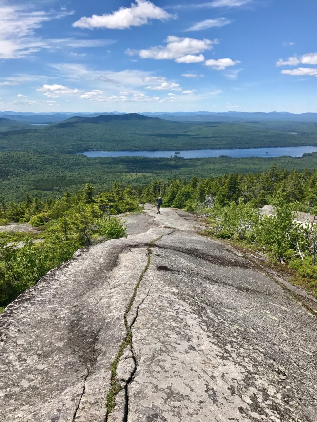
almost there: days 124-127
Day 124: Bigelow Col to East Carry Pond, 18.8 miles Day 125: East Carry Pond to Pleasant Pond Lean-to, 15.9 miles Day 126: Pleasant Pond Lean-to to West Branch of the Piscataquis River, 19 miles Day 127: West Branch of …

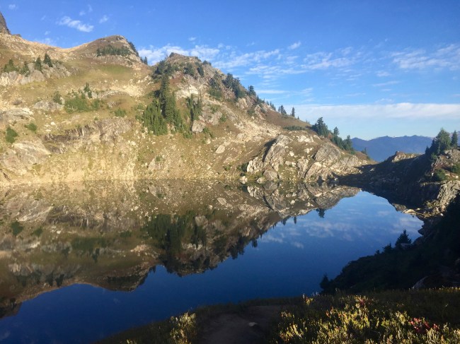
into the mountains: days 121-123
Day 121: Rangeley to Sluice Brook, 13.5 miles Day 122: Sluice Brook to mile 1998.2, 15.3 miles Day 123: mile 1998.2 to Bigelow Col, 11.4 miles Total AT miles hiked: 2009.6 Miles left to go: 180 We left Rangeley for …
sight-seeing: days 115-120
Day 115: Baldpate Lean-to to Hall Mountain Lean-to, 14 miles Day 116: Hall Mountain Shelter to South Arm Road, 4.1 miles Day 117: South Arm Road to Sabbaday Pond Lean-to, 17 miles Day 118: Sabbath Day Pond Lean-to to Route …

return to Maine: days 111-114
Day 111: Zeta Pass to Route 2, 12.7 miles Day 112: Gorham, 0 miles Day 113: Route 2 to Carlo Col Shelter, 16.3 miles Day 114: Carlo Col Shelter to Baldpate Lean-to, 16.4 miles Total AT miles hiked: 1924.9 AT …
